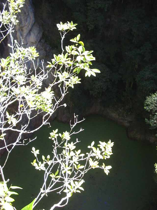
Looking down into the volcanic vent from the viewing platform.
The Mount Hypipamee Crater was formed by volcanic activity 10 000 - 15 000 years ago.
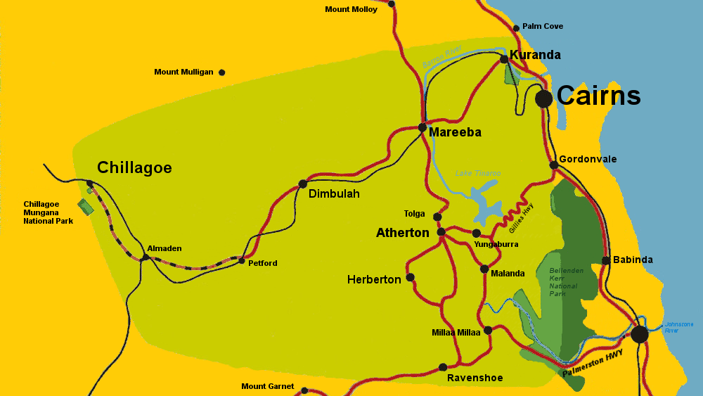
Located 23 kilometers south of Atherton, 27 kilometers north of Ravenshoe and 16 kilometers east of Herberton in the Hugh Nelson Range, Mt Hypipamee National Park protects a unique rainforest environment. It is a high altitude rainforest on the Tropical Atherton Tablelands and temperatures can go as low as -10 degrees Celsius in winter. It is also the headwaters of the Barron River.
The crater is a volcanic pipe formed by a massive explosion of subterranean gas. A platform allows a spectacular view into the crater 58 meters above the lake which has formed below. The lake is about 82 meters deep.
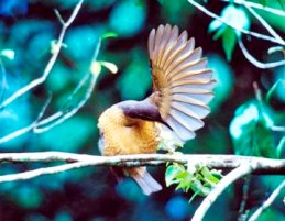
Victoria's Riflebird at Mt. Hypipamee Crater National Park. Photo: NPRSR.
There is an abundance of wildlife and birdlife in the rainforest surrounding the crater, including tree kangaroos, wallabies and scrub turkeys. Possum species include the Green ringtail possum, lemuroid ringtail, and Herbert River ringtail possums, all of which are unique to the north Queensland Wet Tropics rainforests. Bird species include the golden bowerbird, spotted catbird, toothbill bowerbird, and Victoria's riflebird, which belongs to the bird of paradise family.
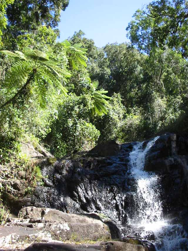
Waterfalls and cascades of the Barron River.
Mount Hypipamee National Park contains swimming areas, and picnic and barbecue facilities. There are public toilets, and the walking path to the crater is sealed and accessible to wheelchairs and families with prams and strollers.
The walking trail from the carpark and picnic area to Mt Hypipamee Crater follows the Barron River very close to its source. From here the Barron River meanders through the Atherton Tablelands dairy country to Lake Tinaroo, before irrigating the fields of Mareeba, then tumbling over the edge of the plateau at Barron Gorge Falls near Kuranda. See also the crater lakes Lake Eacham and Lake Barrine.

The Barron River at its source. This river wends through the Atherton Tablelands and is dammed at Tinaroo before cascading down to Cairns.
Mount Hypipamee crater is situated in the traditional home of the Ngadjon and Jirrbal, aboriginal peoples. There are many legends in their oral culture about the crater.
Vera Smallwood told the following story in 1974:
Once upon a time there was a greedy snake. It collected all the scrub turkey eggs. The scrub turkeys got angry, and chased the snake. The earth, too, got angry and fire came out of the ground, which created a big crater there. The snake, which had been chased, fled into the crater and was trapped in it.
The Grammar of Warrongo, Tasaku Tsunoda, Walter de Gruyter(Pub.), Berlin, 2011
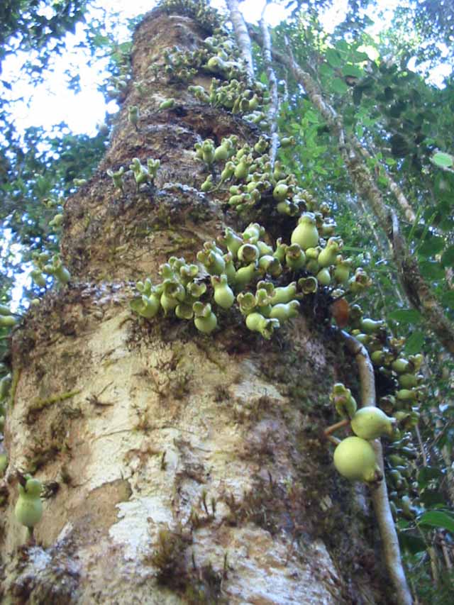
Syzgium Cormiflorum, one of the many interesting species of rainforest flora.
Europeans discovered the crater when miners flocked to Herberton in 1879 and prospected the area for tin and other minerals. Uncited references on the Internet claim it was discovered when 'Weate and party' nearly fell into it on a gold prospecting expedition. James Venture Mulligan had passed very close by on his 1874 expedition, and Joss, Mazlin, and Clarke were probably the most thorough explorers of the locality. Joss and Clarke blazed a trail very close by, and a newspaper article from 1921 claims that it was discovered by Mazlin and Joss. 1921 'HERBERTON MYSTERY SPOT.', Cairns Post (Qld. : 1909 - 1954), 8 November, p. 2, viewed 7 March, 2015, http://nla.gov.au/nla.news-article40142278
Robert Colin Ringrose, a barrister in Herberton, who was also a keen geologist, botanist, conservationist, member of the Royal Society of Queensland, and secretary of the Herberton Chamber of Commerce, successfully lobbied to have the area around the crater held as a Reserve for a National Park in 1908.
This remarkable spot is situated on the Upper Barron River Watershed, about nine miles from Herberton, and about twelve miles from Atherton, in an area of land comprising two square miles, reserved at the instance of the Herberton Chamber of Commerce as a Reserve for a National Park.
R. C. RINGROSE, M.A. {Read before the Royal Society of Queensland, 24th April, 1912) Proceedings of the Royal Society of Queensland v.22-25 1909-1914, Brisbane
Atherton Tableland Netguide ©1998 Last update February 1, 2024 Privacy Policy
About Us Contact Us What's New