
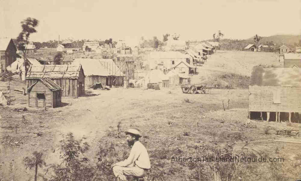
Steeped in pioneer history, the Hodgkinson gold field was once home to 10,000 people and provided stimulus to the development of Cairns and its hinterland.
The gateway to the goldfield is the township of Dimbulah via Mareeba, although access is also possible via rough bush track from Mount Carbine during the dry season (May to October).
Situated north of Dimbulah, the Hodgkinson Gold field is accessible via an unsealed road which is graded once per year. The road is rocky and hard in places but is passable in a conventional vehicle from about April to November. During the wet season, a 4WD is recommended, and at times rivers are in flood making the area inaccessible.
The gold of the Hodgkinson consisted of reef-gold, running in veins of quartz. This meant it required hard rock mining techniques, and ore-crushing mills to be constructed to extract the gold. On hearing of the discovery of gold in the area in 1876, many hopeful diggers rushed to the site with false expectations that they could find alluvial gold in the creeks and rivers as had been the case in the nearby Palmer River gold field. The result was disappointment.
Recent official telegrams from Queensland show that the rush to the new gold-field discovered on the Hodgkinson River is a total failure, and that great hardship is likely to result to many of the diggers who so hastily started for the scene of the new discovery... It is impossible to form any estimate of the value of the field which has now been opened, as an alluvial gold-field. There is very little alluvium to be operated upon anywhere, but that there is a considerable quantity of coarse gold scattered over a very large area...
What turned out to be disappointing news to prospectors equipped with gold pans in 1876, might prove a boon to today's fossickers equipped with a modern gold detector...
Towns sprung up on the Hodgkinson goldfield, the best known being Thornborough and Kingsborough. The town of Cairns was established on the coast to serve the inland communities. Eventually an easier track was found to the coast, which led to the founding of Port Douglas.
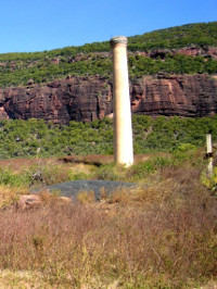
Although once thriving, the goldfield is now home to just a handful of people, and the road out of Dimbulah leads into miles of rugged Australian bush. First stop is the Tyrconnell Historic Gold Mine & Bush Retreat 34km from Dimbulah. The Tyrconnell dates back to 1876 and is one of the last remaining relics from the early gold rush days. It boasts a number of original buildings and an operational ten head quartz crushing machine, and the owners live on site in the old office building.
The Tyrconnell Gold Mine is now operated as a tourist attraction. Tours of the mine site and nearby pioneer cemetery are available, along with heritage cottage accommodation, camping, meals, gold panning, bush walking, and 2 or 3 day packages with transport from Cairns. Pick up is also available from Dimbulah.
The hilltop mine has a wonderful pioneer ambience and excellent views, and is surrounded by tranquil bush. Bookings are essential. The road to Tyrconnell takes you through the former township of Thornborough. Now little remains of this former goldfield capital, but the road north passes the Thornborough cemetery with its 50 remaining graves.
Continuing further north, magnificient Mount Mulligan comes into view. This sandstone plateau, 27km long with bluffs rising sharply 300 meters from the surrounding landscape, is named after the Irish explorer credited with discovering the Hodgkinson goldfield. In 1908 coal was discovered under the mountain, and by 1920 a bustling township of 300 was established at its base.
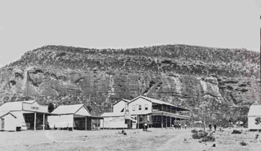
The following year, disaster struck when a coal dust explosion killed 75 men underground. The Mount Mulligan cemetery is testament to this sad event. The mine closed in 1957 and the township, 50km north of Dimbulah, is all but gone. Mount Mulligan cattle station now has its homestead in the old town hospital, and the pastoralist Owen Rankine works the station and runs a farmstay.
The former township is mostly crown land and access is available to anyone. The mountain itself is situated on Kondaparinga cattle station, owned by the Kuku Djungan Aboriginal people, and is not accessible to visitors. The area surrounding the mountain is a perfect escape from the rat-race for visitors, offering miles of unpopulated bush, and unique, hosted experiences.