

Cairns is the traditional home of the Yidinji and Djabugay indigenous peoples. More than other areas of Australia, the rich environmental diversity provided by lush rainforests, plentiful water, and the tropical marine environment provided a reliable and abundant source of food and materials.
The aboriginal population of the region was relatively large, and probably more dense than other parts of Australia. Accounts of early explorers and settlers around Cairns often refer to aboriginal 'villages' and occasionally even 'towns', due to their size, and perhaps a sense of 'permanence' relative to the more nomadic tribes of other areas of the continent.
The aboriginal Australians of Cairns and the surrounding rainforests call themselves the Bama people. Despite the conflicts that ensued during the period of early contact, and the racialist policies of the past, the Bama people have persisted and maintained their cultural heritage.
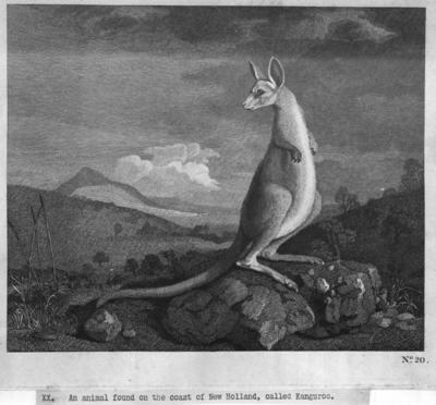
The area occupied by Cairns City was first discovered by Europeans when James Cook sailed by on his 1770 expedition. He landed just south of the present day city, and with Joseph Banks and Daniel Solander made a brief survey of the local flora and fauna. Resuming his journey, he named the site of present day Cairns 'Trinity Bay'. That night, Cook's ship, the Endeavour hit a reef just off Cape Tribulation, forcing the expedition to land and spend an extended stay on the Endeavour River.
Trinity Bay was a long way from where the first colonies of Australia were established from 1788 onwards. Phillip Parker King stopped at Fitzroy Island on his expeditions of 1819, 1820, and 1821 to rewater. But there was no significant exploration of the region. In 1866, a Beche-de-mer station was set up on Green Island.
It was the discovery of gold on the Palmer River, that eventually stimulated interest in the area and led to a detailed survey by George Dalrymple in 1873. After gold was also discovered on the Hodgkinson River, a track was cut through the jungle from the tableland down to the coast, and in 1876 the Governor of Queensland proclaimed a new port at Trinity Bay. Land sales to settlers began in 1877, and the resulting township was named "Cairns" after the Governor, William Wellington Cairns.
In the first days of the Cairns settlement, white workers resisted the introduction of Chinese settlers. The Queensland government saw the Chinese as essential to the successful development of the tropical frontier. Eight Chinese accompanied the government officials who sailed to Trinity Bay to found the new port. However, the Chinese were forced to stay onboard as a crowd of anti-Chinese protestors crowded onshore. The anti-Chinese crowd, mostly disgruntled, unemployed former gold miners, formed a blockade of the port during October of 1876, and several violent encounters ensued, not only against the Chinese, but the government officials including police and police magistrates who accompanied them.
In November of that year, the government sent a force of police, troops, and officials for the official founding of the settlement. A Chinese 'business personage' and several Chinese workers were brought ashore under a heavy police escort. They proved to be indispensable to the development of Cairns and the region.
Chinese settlers set up successful agricultural ventures, and Australia's nascent tropical agriculture industries began to develop around Cairns. In 1879, the Hop Wah plantation was the first in the area to produce sugar cane. By 1886 the Chinese accounted for 60% of all farmers and 90% of the market gardeners around Cairns. Chinese farmers produced rice, corn, bananas and pineapples, among other crops. They played an important part in the development of agriculture in tropical northern Australia. By 1899, the population of Cairns numbered around 3,000 of which around one-third were Chinese.

Unlike the first Australian settlements in the south, Cairns had a very multicultural population from its beginning. A Chinatown developed in Sachs St, which became the second-largest Chinatown in the state of Queensland. Cairns also had a 'Malay Town' around Alligator Creek, where Malays, Javanese, and Pacific Islanders lived, and an 'Indian Camp' developed around the turn of the century. There was also 'Yokohoma' where Japanese lived in Cairns until they were deported at the outbreak of World War II.
Italians had started to migrate to Far North Queensland from the 1890s, and by the 1920s dominated the agricultural industry, with 95% of agricultural workers being Italian, and 60% of farmers around Babinda of Italian descent. Italians, along with migrants from other European countries continued to arrive in large numbers in the post-war immigration period. Today, Italian is the largest non-English language spoken at home around Mareeba on the Atherton Tablelands, and many other towns in Far North Queensland.
Cairns, from its birth had been in stiff competition with nearby Port Douglas. At first, most of the wealth was created inland on the goldfields, which had seen relatively short-term gold rushes. With the development of the base-metals industries around Herberton and Irvinebank, stability came to the region, and by the 1880s demand was growing for a railway from Herberton to the coast. Both Cairns and Port Douglas vied to be the coastal terminus for the line, and the Queensland government finally chose Cairns. The first stage of the line was Cairns to Kuranda, and took 5 years to build. With 15 tunnels and many bridges, at the time it was touted as the most challenging infrastructure project in Australia.

Construction of this line resulted in Cairns gaining importance as a regional center, however, its small population was not enough to gain status as a town. It wasn't until 1903, when the population had grown to 3 500 that township status was granted, and it was only 20 years later that Cairns gained status as a city.
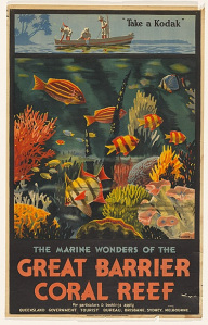
The natural beauty of Cairns, the Great Barrier Reef, and the Atherton Tablelands, attracted tourists from the 1890s and onwards. Travelers arrived by steamship, and from the 1920s by rail. Hotels developed and tour operators advertised trips to Barron Falls and the Atherton Tablelands. By 1910, the Queensland Government Tourist Bureau was advertising regional attractions such as the Chillagoe-Mungana Caves and Lake Barrine.
In 1936, the Cairns City Council established an airport with 3 unsealed runways.
After the fall of Singapore in 1942, Cairns and the Atherton Tablelands became an important operations center for the allied forces fighting in the Asia-Pacific. Many American troops were stationed there, and infrastructure was developed which contributed to the future development of the city and region. The army built a road from Smithfield to Kuranda, which today is an important economic link with the Tablelands and provides a popular scenic route for tourists. The Cairns airfield was purchased by the Australian government and upgraded with a sealed runway and aprons, better buildings, a weather station, and a control tower.
As part of an anti-malaria drive, American troops also provided manpower for improving the drainage around Cairns, which is situated on lowlying land and former mangrove swamps.
The airport runways saw extensions in 1949, then again in 1962 to accommodate jets. Further extensions in the 1980s and 1990s were part of the development of Cairns International Airport, which have helped develop Cairns as an International tourism destination. Cairns Airport is also a base for the Royal Flying Doctor service.
In the 1950s Vince Vlasoff established the world's first underwater observatory off Green Island.
See more historical film and video